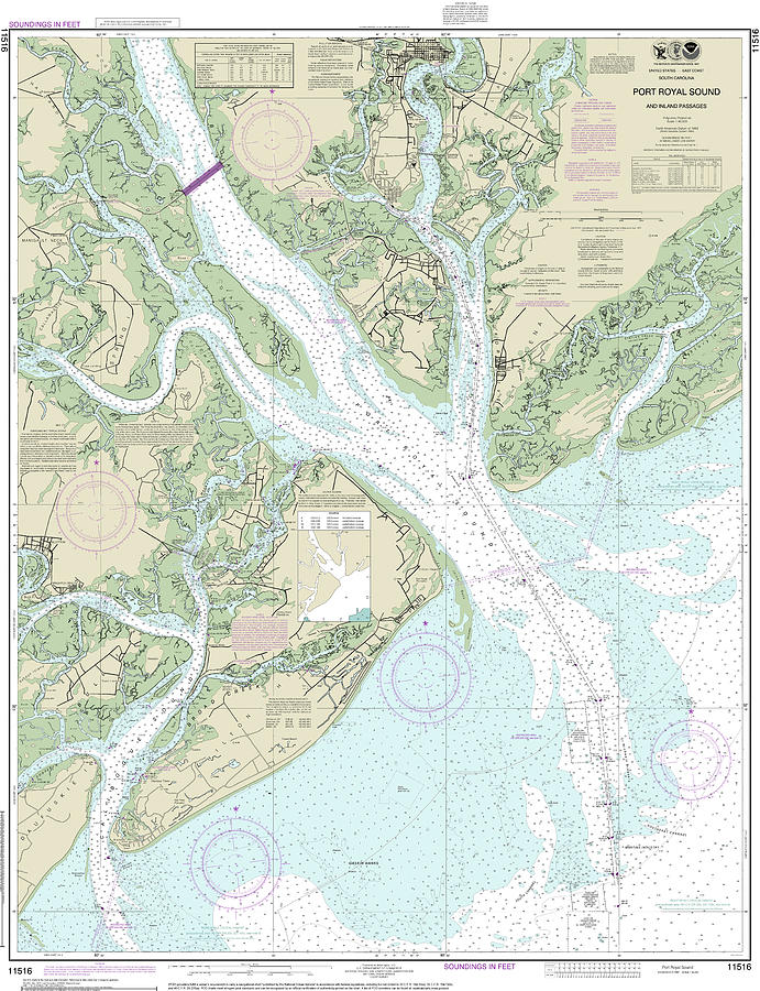
Port Royal Sound and Inland Passages Nautical Chart 11516 is a piece of digital artwork by John Gernatt which was uploaded on April 1st, 2022.
Port Royal Sound and Inland Passages Nautical Chart 11516
This is NOAA chart 11516. It covers an area from Beaufort, South Carolina south to Calibogue Sound, just north of Daufuskie Island. The chart's scale... more

by John Gernatt
Title
Port Royal Sound and Inland Passages Nautical Chart 11516
Artist
John Gernatt
Medium
Digital Art
Description
This is NOAA chart 11516. It covers an area from Beaufort, South Carolina south to Calibogue Sound, just north of Daufuskie Island. The chart's scale is 1:40,000. This chart covers less area than charts with a scale of 1:80,000. However, charts with a scale of 1:40,000 provide greater detail for navigational features and references. Color shading on the chart indicates various water depths and land elevations. Depth Soundings are in feet. Also included on the chart are aids and hazards to navigation. Typically mariners use nautical charts covering the South Carolina coasts for navigation. Chart 11516's purpose is for near-shore and intercostal navigation. NOAA is phasing out its paper charts. Electronic charts for onboard navigation are replacing paper charts. Certain products in our collection utilize cropped elements on the chart. We remove sections to improve the overall aesthetic quality of the image. Cropping and reprinting charts make them unsuitable for navigation. However, the charts in this collection are ideal for home and business decor. Framed nautical charts make great conservation pieces. Nautical charts printed on other products in our collection make excellent additions to the decor in living areas, bedroom areas, and bathrooms. Nautical charts are also printed on various accessories and apparel.
Signiant landmarks and navigational references include Beaufort, Ladys Island, Calibogue Sound, Daufuskie Island, Port Royal Sound, Phillips Island, Port Royal, Hilton Head Island, Broad Creek, Gaskin Banks, Savage Island, Bryan Landing, Bluffton, Brighton Beach, Beaufort River, Spring Island, Callawassie Island, Hazard Neck, Manigault Neck, Capers, Bull Point, Prichards Inlet,
Uploaded
April 1st, 2022
More from John Gernatt
Comments
There are no comments for Port Royal Sound and Inland Passages Nautical Chart 11516. Click here to post the first comment.


